
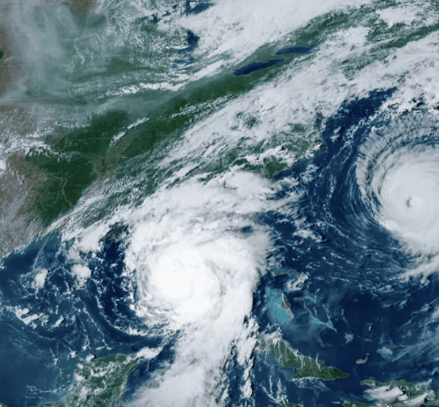
Rapid intensification of the 2026–27 El Niño, with Niño 3.4 sea surface temperature anomalies reaching +2.5 to +2.9°C by mid-September, underpins the 73% market-implied probability it becomes the strongest on record. Multi-model ensembles from NOAA, ECMWF, and others project a peak of +3.0 to +3.6°C during October–December, exceeding prior benchmarks like 2015–16 and 1997–98 by a wide margin, with over 90% odds of a very strong event and 69–75% chance of a historic peak since 1950. The World Meteorological Organization notes exceptional warming across the tropical Pacific and near-100% persistence into early 2027, while atmospheric signals including a strongly negative Southern Oscillation Index confirm strengthening. Forecasters emphasize model consensus on this trajectory, though inherent ENSO variability and exact peak timing introduce remaining uncertainty ahead of late-fall updates.
Експериментальне резюме, згенероване ШІ з посиланням на дані Polymarket. Це не торгова порада і не впливає на вирішення цього ринку. · ОновленоWill the 2026–27 El Niño be the strongest on record?
Will the 2026–27 El Niño be the strongest on record?
The peak RONI is the single highest RONI value reported by NOAA's Climate Prediction Center (CPC) across the overlapping three-month seasons ASO 2026, SON 2026, OND 2026, NDJ 2026-27, and DJF 2026-27, as reported in official NOAA CPC RONI updates. The record to beat is +2.40°C, set in DJF 1982-83, the highest RONI value for any three-month season in CPC's record. A peak RONI of exactly 2.40°C ties the record and resolves this market to "No".
The first published RONI value for each listed season is final and governs this market's resolution. This market may resolve immediately upon NOAA's first publication of a RONI value of above 2.40°C for any listed season.
If CPC's RONI dataset becomes temporarily unavailable, this market may be extended for up to 7 days. If CPC's RONI dataset is permanently discontinued, a consensus of credible reporting may be used. If the dataset remains unavailable after 7 days and there is no consensus of credible reporting, this market resolves to "No".
No subsequent revision to a season's value will be considered or will change the outcome once that season's first value has been published. The +2.40°C threshold is fixed for the purposes of this market; any later revision to a historical season's RONI value will not change it.
The resolution source for this market is the official NOAA CPC RONI updates, available here: https://www.cpc.ncep.noaa.gov/products/analysis_monitoring/enso/roni/
Ринок відкрито: Sep 14, 2026, 11:23 AM ET
Вирішувач
0x65070BE91...The peak RONI is the single highest RONI value reported by NOAA's Climate Prediction Center (CPC) across the overlapping three-month seasons ASO 2026, SON 2026, OND 2026, NDJ 2026-27, and DJF 2026-27, as reported in official NOAA CPC RONI updates. The record to beat is +2.40°C, set in DJF 1982-83, the highest RONI value for any three-month season in CPC's record. A peak RONI of exactly 2.40°C ties the record and resolves this market to "No".
The first published RONI value for each listed season is final and governs this market's resolution. This market may resolve immediately upon NOAA's first publication of a RONI value of above 2.40°C for any listed season.
If CPC's RONI dataset becomes temporarily unavailable, this market may be extended for up to 7 days. If CPC's RONI dataset is permanently discontinued, a consensus of credible reporting may be used. If the dataset remains unavailable after 7 days and there is no consensus of credible reporting, this market resolves to "No".
No subsequent revision to a season's value will be considered or will change the outcome once that season's first value has been published. The +2.40°C threshold is fixed for the purposes of this market; any later revision to a historical season's RONI value will not change it.
The resolution source for this market is the official NOAA CPC RONI updates, available here: https://www.cpc.ncep.noaa.gov/products/analysis_monitoring/enso/roni/
Вирішувач
0x65070BE91...Rapid intensification of the 2026–27 El Niño, with Niño 3.4 sea surface temperature anomalies reaching +2.5 to +2.9°C by mid-September, underpins the 73% market-implied probability it becomes the strongest on record. Multi-model ensembles from NOAA, ECMWF, and others project a peak of +3.0 to +3.6°C during October–December, exceeding prior benchmarks like 2015–16 and 1997–98 by a wide margin, with over 90% odds of a very strong event and 69–75% chance of a historic peak since 1950. The World Meteorological Organization notes exceptional warming across the tropical Pacific and near-100% persistence into early 2027, while atmospheric signals including a strongly negative Southern Oscillation Index confirm strengthening. Forecasters emphasize model consensus on this trajectory, though inherent ENSO variability and exact peak timing introduce remaining uncertainty ahead of late-fall updates.
Експериментальне резюме, згенероване ШІ з посиланням на дані Polymarket. Це не торгова порада і не впливає на вирішення цього ринку. · Оновлено
Обережно з зовнішніми посиланнями.
Обережно з зовнішніми посиланнями.
Часті запитання