

Favorable environmental conditions and rapid recent intensification are driving the near-certain market consensus that Tropical Storm Karina will reach hurricane strength. National Hurricane Center observations show the system already at 70–80 mph sustained winds with a developing inner core, light vertical wind shear, warm sea surface temperatures, and high atmospheric moisture supporting further strengthening over the next 24–48 hours. Official forecasts indicate it will become a major hurricane well offshore, consistent with SHIPS and ensemble model guidance showing elevated rapid intensification probabilities. Only an abrupt, unexpected environmental shift—such as a sharp increase in shear or cooler waters—could prevent threshold crossing, though current data indicate minimal risk of that outcome before resolution.
Tóm tắt AI thử nghiệm tham chiếu dữ liệu Polymarket. Đây không phải tư vấn giao dịch và không ảnh hưởng đến cách thị trường này được giải quyết. · Cập nhậtWill Tropical Storm Karina strengthen to a hurricane?
Will Tropical Storm Karina strengthen to a hurricane?
$4,802 KL.
$4,802 KL.
$4,802 KL.
$4,802 KL.
Karina reaches hurricane strength if it attains a maximum sustained wind speed (1-minute average) of at least 74 mph, corresponding to Category 1 or higher on the Saffir-Simpson Hurricane Wind Scale, as reported by the National Hurricane Center. Reaching hurricane strength at any single advisory during the market's timeframe is sufficient to resolve this market to "Yes", regardless of the storm's intensity at other times.
The primary resolution source for this market will be the operational advisories issued by the National Hurricane Center (https://www.nhc.noaa.gov/). If Karina is located outside the National Hurricane Center's area of responsibility, the maximum sustained wind speed reported by the responsible Regional Specialized Meteorological Center will be used.
This market will resolve based on the operational advisory data issued while the storm is active. Any revisions to the storm's peak intensity or category published later in a post-storm best-track report or Tropical Cyclone Report will not be considered for this market's resolution.
If Karina does not reach hurricane strength by September 5, 2026, 11:59 PM ET, or dissipates before reaching hurricane strength, this market will resolve to "No".
Thị trường mở: Aug 27, 2026, 5:19 PM ET
Nguồn giải quyết
https://www.nhc.noaa.gov/Người giải quyết
0x65070BE91...Kết quả đề xuất: Yes
Không tranh chấp
Kết quả cuối cùng: Yes
Karina reaches hurricane strength if it attains a maximum sustained wind speed (1-minute average) of at least 74 mph, corresponding to Category 1 or higher on the Saffir-Simpson Hurricane Wind Scale, as reported by the National Hurricane Center. Reaching hurricane strength at any single advisory during the market's timeframe is sufficient to resolve this market to "Yes", regardless of the storm's intensity at other times.
The primary resolution source for this market will be the operational advisories issued by the National Hurricane Center (https://www.nhc.noaa.gov/). If Karina is located outside the National Hurricane Center's area of responsibility, the maximum sustained wind speed reported by the responsible Regional Specialized Meteorological Center will be used.
This market will resolve based on the operational advisory data issued while the storm is active. Any revisions to the storm's peak intensity or category published later in a post-storm best-track report or Tropical Cyclone Report will not be considered for this market's resolution.
If Karina does not reach hurricane strength by September 5, 2026, 11:59 PM ET, or dissipates before reaching hurricane strength, this market will resolve to "No".
Nguồn giải quyết
https://www.nhc.noaa.gov/Người giải quyết
0x65070BE91...Kết quả đề xuất: Yes
Không tranh chấp
Kết quả cuối cùng: Yes
Favorable environmental conditions and rapid recent intensification are driving the near-certain market consensus that Tropical Storm Karina will reach hurricane strength. National Hurricane Center observations show the system already at 70–80 mph sustained winds with a developing inner core, light vertical wind shear, warm sea surface temperatures, and high atmospheric moisture supporting further strengthening over the next 24–48 hours. Official forecasts indicate it will become a major hurricane well offshore, consistent with SHIPS and ensemble model guidance showing elevated rapid intensification probabilities. Only an abrupt, unexpected environmental shift—such as a sharp increase in shear or cooler waters—could prevent threshold crossing, though current data indicate minimal risk of that outcome before resolution.
Tóm tắt AI thử nghiệm tham chiếu dữ liệu Polymarket. Đây không phải tư vấn giao dịch và không ảnh hưởng đến cách thị trường này được giải quyết. · Cập nhật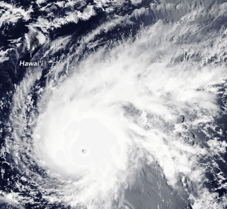

Cẩn thận với liên kết bên ngoài.
Cẩn thận với liên kết bên ngoài.
Câu hỏi thường gặp